On May 24, 1908, Biblical rain soaked Dallas with devastating consequences. A 1957 Dallas Morning News article described it. “The leaden heavens continued to send down torrents of rain as the day wore on,” causing the Trinity River to crest at 52.6 feet. It knocked out the city’s power and water supplies and displaced 4,000 people from their homes. A police horse drowned on McKinney Avenue, and three people died when the rushing water took out the railroad viaduct where they were watching the raging flow. The waters paralyzed the city for days.
Since the 1800s, the river has both frustrated and captured the imagination of Dallasites. In 1910, urban planner George Kessler designed a plan to unbend the river and build levees to prevent such a flood from happening again.
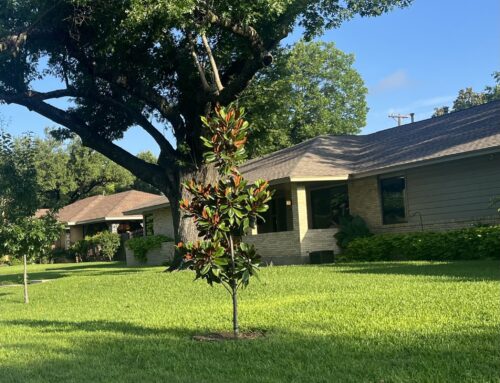
In the 1920s, engineers straightened the river, allowing it to flood between the levees and flow quickly downstream, protecting a Downtown that regularly flooded. Today, the Trinity runs in a straight southwest path just west of Downtown, dividing it from Oak Cliff. Most of the year, it remains a small band inside its banks, with expansive floodplains on either side and levees rising beyond. Every so often, heavy rains will cause the river to flood its banks, at times making its way up the levees.
“Harold Simmons Park will deliver the opportunity where the community can really engage and experience true urbanism as a park.”
Dallas leaders once envisioned a highway in the flood plain. Over a couple decades, Dallas and the infamous Trinity Toll Road were the Ross and Rachel of North Texas development. Voters approved it twice, but after East Dallas Councilwoman Angela Hunt led a charge against putting a highly trafficked road in a flood plain, public opinion and leadership turned against the toll road. The toll road plan had one last fling and finally was put to bed last year.
Other than simple trails along the levees and down near the river, the area remains relatively undeveloped. At one point there was an ill-fated $4 million “standing wave” installed into the river. The U.S. Army Corps of Engineers determined that feature made the river unnavigable, and the city removed it earlier this year at a cost of $2 million.
The latest vision is Harold Simmons Park, a 200-acre flood-friendly park between the levees, running from the Ron Kirk Pedestrian Bridge in the north to the Margaret McDermott Bridge in the south. The Simmons family donated $10 million toward the development of the park, with $40 million more to come if the organization meets governance and fundraising goals.
While not as contentious a fight as the one that killed the Trinity toll-road plan, not everyone agrees on what $200 million should pay for between the levees.
From the ashes of several iterations of Trinity design, a nonprofit organization called the Trinity Park Conservancy rose to lead the charge in fundraising, designing and seeking public input about what the park should be. The park will be developed in a public-private partnership between the city and the conservancy, called a Local Government Corporation.
Trinity Park Conservancy President and CEO Brent Brown has been attached to the Trinity project for more than a decade, and now he is tasked with building a park between the levees. Brown founded bcWorkshop, a nonprofit design firm that sought to improve life in Dallas. The nonprofit founded and directed CityDesign Studio, which contracted to guide design for the City of Dallas from 2011-2017.
Brown says he wants to turn the green space into something that stitches the city together and entices Dallasites from both sides of the Trinity. “The park is a vehicle,” he says. “Yes, we are building a park, but we are also building a city.”
Designing a park in a flood plain will require a unique sensitivity to nature, he says. “There is a tension between the natural forces surrounding our river and the physical construction and management of the space,” he says. “Nature is fighting to have it be less manmade. We are going to build a park, and it is going to flood.
What should a park that floods look like? There are precedents. Buffalo Bayou Park in Houston is made to flood and managed by a government and nonprofit partnership, though it is smaller. Buffalo Bayou includes nature trails, a dog park, a skate park and more, running along the flood-prone bayou near downtown.
New York-based landscape architect Michael VanValkenburgh’s firm was selected for the park, but the design and elements are still up in the air and open to input from Dallas residents.
“For rewilding, the money is already there. That would be so low-cost.”
Brown wants to create access to the river bottom while connecting it to the community, balancing natural existence with recreational enjoyment. “It has to work in the context of flooding. Our approach is the most pragmatic to date,” he says.
Not everyone is sold on that vision.
City Councilman Scott Griggs, who opposed the Trinity toll-road “boondoggle” even before he was elected to Council in 2011 and was part of the new guard that finally slayed it, says a park between the levees doesn’t have to cost $200 million.
“For rewilding, the money is already there. That would be so low cost,” he says.
The city already has $47 million from bond funds for the park. Rewilding, which prioritizes the natural ecology and encourages migratory birds and native plants, wouldn’t require a name-brand architect or a billionaire’s endowment.
“They want to do these fancy monuments to themselves,” Griggs says. “And leave taxpayers with the bill on the maintenance.”
Griggs points to the $4-million whitewater feature the Trinity Conservancy’s predecessor pushed at Oak Cliff’s Moore Park. Soon after it was installed, the U.S. Army Corps of Engineers determined the “standing wave” made the river un-navigable, and the city opted to remove it earlier this year at a cost of $2 million, a couple of million cheaper than fixing it.
“And that was a top project of the Trinity Conservancy,” Griggs says. “That’s one way they operate is to try to build grand designs and then there’s some ‘value engineering’ that makes it unusable.”
Consider the Margaret McDermott Bridge, another top project of the conservancy’s predecessor. Bike lanes on that bridge currently are off limits because the city paid for a Santiago Calatrava design but pinched pennies on engineering.
“My hope is that they learn from their previous mistakes and acknowledge that we want a park where we can live with nature,” Griggs says. “All people really want down there is to see nature, to see birds, they want it rewilded, and they want simple trails.”
City Councilman Philip Kingston, also a staunch toll-road opponent, says Brown’s CityDesign Studio showed support for a toll road. As proof, he says the group awarded its Connected City Design Challenge award to a Spanish firm that included a toll road in its renderings. “Brent Brown has no more cred in that job than Harold Simmons would have,” Kingston says, referring to the Dallas businessman and philanthropist who died in 2013 and once operated nuclear waste dumps in West Texas. “It is in the hands of the same people.”
Brown is proud of his connection to the Trinity plans. He says he never personally advocated for a toll road. He is building out a team of local firms to advise on the construction of the park, including hydrologists and experts in blackland prairies.
When Council voted on the LGC, Griggs won amendments, including one that requires at least one conservationist on the board.
Kevin Sloan, a local landscape architect on the park’s design committee, is that. He’s advocating for rewilding.
Rewilding begins with the natural order of things rather than prioritizing humans. Sloan already is working to re-wild an adjacent section of the river, which he sees as a good partner for Simmons Park. “Cross pollination between the two projects is happening,” he says.
Oak Cliff-based architect Robert Meckfessel also is on the Trinity Conservancy board.
“We want to work with the natural rhythms of the river. The river will flood,” Meckfessel says. “We’re striving for a park that can be used at different levels of flooding. When the river goes into a flood stage, the park will still be usable although in a different way.”
Urban access points as well as natural parts of the park, including rewilding the wetlands and prairie, are part of Brown’s vision too, he says. “To assume those approaches would be absent from Harold Simmons Park is false,” Brown says.
Brown says his grand vision for the Trinity is one of justice and inclusion that aligns with the needs of the people of Dallas, making the city more equitable and healthy along the way. Over the next few years, neighbors will see whether the river that once paralyzed Dallas can transform into a green space for everyone. Brown says they want to complete the design and break ground by 2020, completing the park in 2022. “Trust is a huge factor,” he says. “We don’t expect people just to trust us. We don’t earn it by telling people, but by doing things, listening and evolving.”