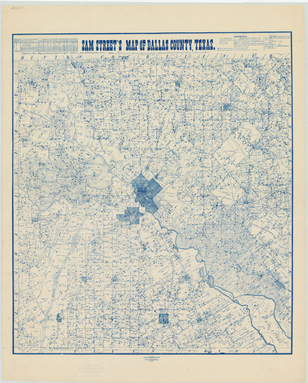
In 1900, the City of Dallas comprised a few square miles, and Oak Cliff was still its own municipality.
This map, donated to the Texas State Archives by H.L. DeGolyer in 1944, shows Dallas before White Rock Lake, before paved roads, when horse-and-buggy or steam-powered streetcars were the best modes of transportation.
Find a larger version of the above map here.
It shows that W.H. Hord, the original white settler of Oak Cliff, still owned about a third of the area. There were three rail crossings over the Trinity River.
Even though there are no streets, some of the farmers’ names are familiar, including Overton, Coombs and Ledbetter.
We came across this map as well as this one from 1891 and this one from 1905, which does name the streets, among others on the freshly redesigned Texas State Library and Archives website.